

8 Days Chitral Kumrat Tour
Chitral · Kumrat
8D · 7N · By road
Rs 263,010 onwards
PTG Verified

Famous for
A forested valley in Upper Dir along the upper Panjkora River, known for deodar forests, riverside camping, Kumrat Waterfall and treks to Jahaz Banda and Katora Lake.
Temperatures are typical seasonal ranges. Mountain weather changes quickly, so check the forecast before you travel.
Famous for: A forested valley in Upper Dir along the upper Panjkora River, known for deodar forests, riverside camping, Kumrat Waterfall and treks to Jahaz Banda and Katora Lake.
Kumrat Valley is known for dense forests, meadows and river scenery in Upper Dir.
Kumrat Valley is part of the itinerary in these 4 packages.
Chitral · Kumrat
8D · 7N · By road
Rs 263,010 onwards
PTG Verified
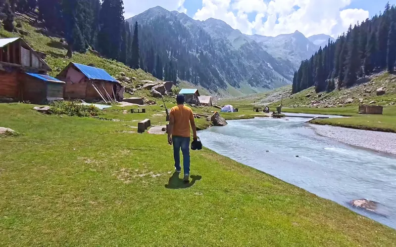
Kumrat Valley
4D · 3N · By road
Rs 134,657 onwards
PTG Verified

Chitral
9D · 8N · By road
Rs 400,000 onwards
PTG Verified

Kumrat Valley
5D · 4N · By road
Rs 221,000 onwards
PTG Verified
Share dates, group size, and destinations — get a clear quotation on WhatsApp.


